Montecito, CA, is an unincorporated coastal community in Santa Barbara County. Bounded by the Pacific Ocean and the Santa Ynez Mountains, it covers about nine square miles of Southern California coastline. An ultimate guide for Montecito, CA provides a complete overview of this unique coastal stretch.
The local population hovers around 8,500 to 9,000 residents. The area features a Mediterranean climate, meaning mild, wet winters and warm, dry summers, which drives a significant portion of the outdoor lifestyle here.
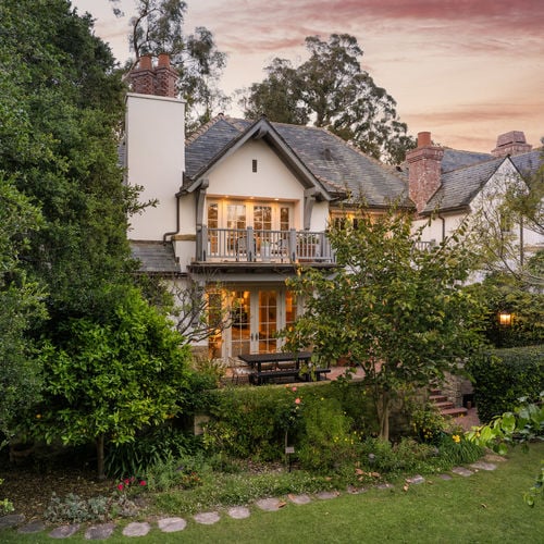
Strict local zoning rules preserve the area's large lot sizes and shape the neighborhood layout. Buyers will also encounter a real estate market with prices well above state and national averages.
Geography and Climate of Montecito
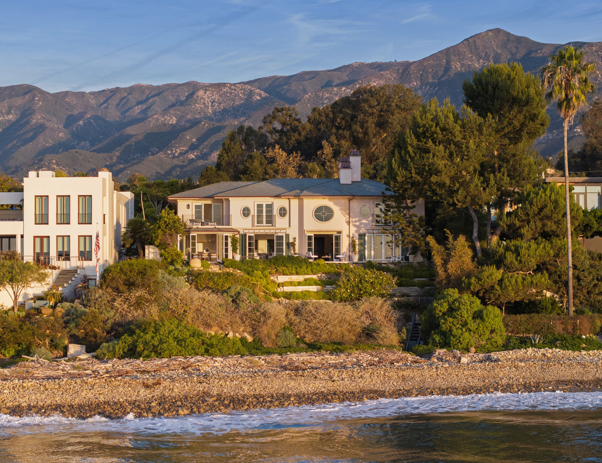
Montecito sits directly east of the city of Santa Barbara, occupying a narrow strip of land between the Santa Ynez Mountains and the Pacific Ocean. This geography creates a microclimate with temperatures typically remaining between 50 and 75 degrees year-round.
The community operates as an unincorporated area within Santa Barbara County, meaning local services like zoning and road maintenance fall under county jurisdiction. There is no local mayor or city council, though various community associations advocate for neighborhood interests.
Strict zoning laws limit dense commercial development and multi-family housing. The result is a residential environment focused on privacy, with large setbacks, winding roads without sidewalks, and heavy tree canopies.
Real Estate and Home Prices in Montecito
As of May 2026, the median sale price for homes in Montecito is around $5,700,000, with properties staying on the market for roughly 89 days. Inventory levels generally remain low, with around 60 active listings at any given time.
Recent data shows homes selling for about 96% of their list price, and roughly 8% of properties sell above the asking price. The housing inventory consists almost entirely of single-family homes, with a large concentration of expansive gated estates.
Properties in the "Golden Quadrangle", an area located north of East Valley Road, frequently exceed $10,000,000 due to their ocean views and multi-acre lots. Lot sizes vary by location, but zoning generally mandates larger parcels to preserve the area's low-density feel.
Buyers should anticipate high property taxes corresponding to these purchase prices. The coastal and mountainous terrain also requires substantial ongoing maintenance costs for landscaping and property upkeep.
Local Schools and Education Options
Montecito is served by two distinct public elementary school districts: the Montecito Union School District and the Cold Spring School District. Both districts are geographically small and funded primarily through local property taxes.
Montecito Union School covers grades K through 6 and serves the central and eastern portions of the community. The campus sits on San Ysidro Road and offers specialized programs in arts, music, and physical education.
The Cold Spring School District serves grades TK through 6 for students residing in the western section of Montecito, closer to Santa Barbara.
For secondary education, Montecito does not have its own public junior high or high school. Students transition into the Santa Barbara Unified School District, typically attending Santa Barbara Junior High and Santa Barbara High School.
Shopping and Dining in the Upper and Lower Villages
Commercial activity in Montecito is concentrated in two primary hubs known as the Upper Village and the Lower Village. These distinct areas separate the community's retail and dining options from its residential zones.
The Upper Village is located at the intersection of East Valley Road and San Ysidro Road. This area provides daily conveniences, including a local grocery store, a pharmacy, banking services, and several independent boutiques and cafes.
The Lower Village runs along Coast Village Road, situated just parallel to Highway 101. This corridor features a higher density of retail stores, fine dining restaurants, and commercial offices.
The Lower Village also connects directly to luxury hospitality properties like the Rosewood Miramar Beach. Another notable retail center is the Montecito Country Mart, which houses upscale apparel shops, an independent bookstore, and specialty food vendors.
Parks, Beaches, and Outdoor Recreation
Montecito offers direct access to several public beaches and miles of mountain hiking trails. The area's natural geography allows residents to travel from the coastline to elevated canyons within a few miles.
The shoreline is primarily divided between Butterfly Beach and Miramar Beach. Butterfly Beach faces west, making it a common spot for evening walks, though parking is limited to street spaces along Channel Drive.
Miramar Beach features calmer waters and is partially bordered by the Rosewood resort. Public access points are available, though visitors should note that high tides often submerge a significant portion of the sand.
Inland, the Santa Ynez Mountains provide numerous hiking paths with varying elevation gains. Local trailheads include:
San Ysidro Trail: A path that follows a seasonal creek up the canyon, eventually leading to a waterfall.
Hot Springs Canyon: A trail known for its natural thermal pools, requiring a steady uphill climb.
Cold Spring Trail: Offers shaded sections and creek crossings, connecting to the larger backcountry trail network.
Commuting and Highway Access
Highway 101 serves as the primary transportation corridor connecting Montecito to the rest of the Central Coast and Southern California. Most residents rely on personal vehicles for daily travel, as public transit options remain limited.
The drive time to downtown Santa Barbara is typically 10 to 15 minutes without traffic. Commuters should factor in the ongoing Highway 101 widening project, which is scheduled for completion in 2028 and causes intermittent lane closures.
For air travel, the Santa Barbara Airport is approximately 15 miles away, which usually takes 20 to 30 minutes by car. The airport offers direct flights to major regional hubs like San Francisco, Denver, and Phoenix.
Los Angeles is located about 90 miles south of Montecito. Driving to the Los Angeles area takes anywhere from 1.5 to 2 hours, though traffic on the 101 or the Pacific Coast Highway can extend that time significantly.
Frequently Asked Questions About Moving to Montecito
What are the pros and cons of living in Montecito, CA?
Residents gain immediate access to quiet, low-density neighborhoods and year-round outdoor recreation. In exchange, buyers face steep property values, heavy ongoing landscaping expenses, and the need for specialized property insurance.
What is the cost of living in Montecito, CA?
Beyond multi-million-dollar purchase prices, residents must budget for substantial property taxes tied to those valuations. The area's large lots and coastal terrain also require larger budgets for specialized landscaping, utilities, and home upkeep.
Is Montecito prone to wildfires or mudslides?
Yes, the area's geography makes it susceptible to both. The steep Santa Ynez Mountains create wildfire risks during dry seasons, and subsequent heavy rains can lead to debris flows, requiring homeowners to secure specialized property insurance.
What is the real estate market like in Montecito, CA?
Available inventory rarely exceeds a few dozen active listings, keeping competition tight for well-maintained estates. Buyers typically need strong financing and should expect limited negotiation room, especially for parcels offering unobstructed ocean views.
What is the difference between buying a home in Montecito's Upper Village versus the Lower Village?
Homes near the Upper Village often feature larger, more secluded lots located in the foothills with mature landscaping. Properties closer to the Lower Village and Coast Village Road offer quicker pedestrian access to dining and the beach, but may experience more traffic noise from Highway 101.
How do public schools in Montecito compare to local private school options?
Since the local public districts only cover elementary grades, families must plan for secondary education transitions. Many parents utilize the Santa Barbara Unified system for junior high and high school, while others opt for the continuous K-12 curriculums available at nearby private academies.
How long is the commute from Montecito to downtown Santa Barbara or Los Angeles?
Daily travel relies heavily on Highway 101, where ongoing construction projects frequently alter traffic patterns. Commuters heading south toward Ventura or Los Angeles should monitor peak travel times to avoid severe delays along the coast.
Check out this article next